
Hiking the Northern Coastal shores of the Oregon Beaches
- Jan 29, 2019
- 3 min read
Updated: Jan 29, 2019
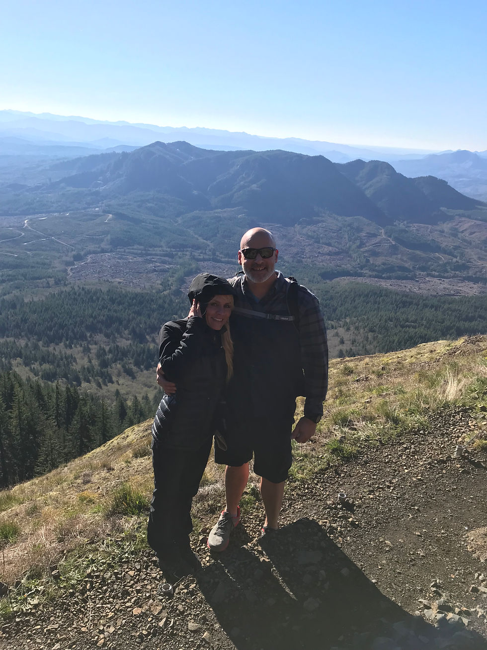
Love what you do... and who you do it with. #honeymoonhikers

Saddle Back Mountain
This peak made the listing on Oregon's Register of Natural Heritage Resources, it is reported to be the tallest mountain in Clatsop County (part of Oregon Coastal Range).
To summit this peak it will take just over 2 1/2 miles in length... all upwards (our gps watch showed just over 2.5 from our vehicle). The information that we read somewhere while searching for a place to hike, estimated that the parking elevation was approximately 1600-1700 feet, however hiking to the top Chris' watch displayed 3,290 feet above sea level. Although we do not believe this to be a strenuous hike, it would be advised to wear the proper hiking boots. We noticed many slippy areas. Additionally, there were such powerful wind gusts that you will want sturdy foot steps. Often times, I felt as if the wind gust was going to knock me over the side cliff (it is that powerful). The chill of the wind at the top was almost unbearable for me to last very long for the view and photo-shoot, but thankfully I managed.
The day we went, it was clear. We were able to see the Columbia River as it entered the Pacific Ocean and the Pacific shoreline - which was truly fabulous. The Cascade Mountains are visible with a 360 degree vision - so you can see the Oregon and Washington Cascades. There are times that the footing is a bit dangerous and slick, taking your time to walk over these areas would be most beneficial - even with the added safety precaution of the handrails.
For all of you dog lovers, we would recommend that if you must take your four-legged family member, that you keep them on a short leash. I noticed that I did not have much room at one point - when a large dog was wanting to barge through - that area was one of the most narrow spots of the terrain, and with wind gusts it was a tad scary. We love dogs and understand that dog owners want their pets with them, however this hike may be one that you would want to think twice about and just allow them out of the vehicle to play near the picnic area and parking lot. (This is just a thought for the safety of your four-legged buddy and the two-legged hikers on the trail.) This spot was a true gem in the Northern Coastal area, we feel fortunate to have hiked this mountain top.
Bonus Info
For those hikers that may not want to attempt the higher altitude and the bi-polar personality of the Mountain's ever changing weather pattern, there is a viewpoint that you may attempt. It will take most average hikers a 10 minute stroll up and it is there, that you can get a peak-a-boo view of Humbug Mountain and the valley.
Tip:
You should have your own backpack full of warm -waterproof gear (i.e. hand warmers, hats, jacket, gloves, face shield). Most likely, if you are an advanced hiker, you will do as we did...and you will be taking these off and on the entire hike. The weather is blustery... and seemed to be changing depending on the exposure. Some times you are in tree coverage, other times you are up high in the sky... climbing to the peak - and exposed to the brutal wind.
Here’s how to manage this hike without all of the foot traffic (it is a popular hike):
Head up early in the morning.
Park in the gravel area (this is available, when you get there early).
Use the restroom before you head up.
Bring plenty of tissue (it gets windy)
Bring a backpack with water and snacks
Wear comfortable hiking BOOTS (the terrain is slippy
Take time to enjoy each viewing spot, the hike has many peak-a-boo shots of various mountains and valleys, take it in. Smile if you make it here.
Enjoy the company you bring.


Comments